18% GST chargeable at checkout, GST Invoice issued.
Key Features
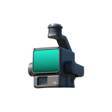
High Precision Accuracy
- Vertical Accuracy: 4 cm
- Horizontal Accuracy: 5 cm
- Ranging Accuracy: 2 cm at 150 m
- Detection Range: Up to 450 m at 50% reflectivity, 0 klx; 250 m at 10% reflectivity, 100 klx
- Maximum Returns: 5
- Point Cloud Rate: Up to 1,200,000 pts/s with multiple returns
- Field of View (FOV): Horizontal 70°, Vertical 3°
- Scanning Modes: Repetitive and non-repetitive patterns
Integrated RGB Camera
- Sensor: 4/3 CMOS
- Resolution: 20 MP
- Minimum Shooting Interval: 0.7 seconds
- Functionality: Provides true-color data for point clouds and supports photogrammetry missions.
System Integration Compatibility
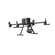
- Supported Platforms: DJI Matrice 300 RTK and Matrice 350 RTK
- Software Integration: Seamless operation with DJI Pilot 2 and DJI Terra for real-time point cloud visualization and post-processing
- Turnkey Solution: Simplifies LiDAR scanning workflow with one-click processing and real-time data preview.
Operational Efficiency
- Coverage: Can survey up to 2.5 km² in a single flight
- Startup Time: Ready for operation immediately after powering on
- Environmental Adaptability: IP54-rated for dust and water resistance; operational temperature range from -20°C to 50°C
Applications
The Zenmuse L2 is ideal for:
- Topographic and cadastral surveying
- Forestry management and vegetation analysis
- Infrastructure inspection (e.g., power lines, bridges)
- Urban planning and construction
- Environmental monitoring


